
Watching a disaster from space: What the Rapidan Dam failure teaches us about river dynamics

In late June 2024, the Rapidan Dam on the Blue Earth River in Minnesota underwent a catastrophic partial failure due to historic flooding. While local authorities managed the immediate crisis on the ground, the recently launched Surface Water and Ocean Topography (SWOT) satellite was capturing the event with unprecedented radar observations. These observations allow us to understand how dam failure disasters reshape river systems.

Traditionally, tracking the geomorphic impact of a dam failure is a slow process involving post-event fieldwork or aerial surveys. However, SWOT’s Ka-band radar enables new, large-scale observations of dam failures even during the storm events that cause the failures. For the Rapidan Dam, SWOT’s River Single Pass data provided a precise record of the river’s water surface elevation before, during, and after the breach. This allowed scientists to see exactly how the river's physical profile was forced to adapt to the sudden loss of the structure.
Perhaps the most striking finding from the SWOT data was the initiation, and upstream propagation, of a transient “knick zone”, i.e. a localized, oversteepened section of the river where the water drops rapidly. This oversteepened section causes the river to incise quickly into the channel’s bed, leading to the upstream migration of the knick zone. Such transient knick zones have been shown to exist in numerical simulations and physical flume experiments, but this is the first time a transient knick zone profile has been tracked from space.
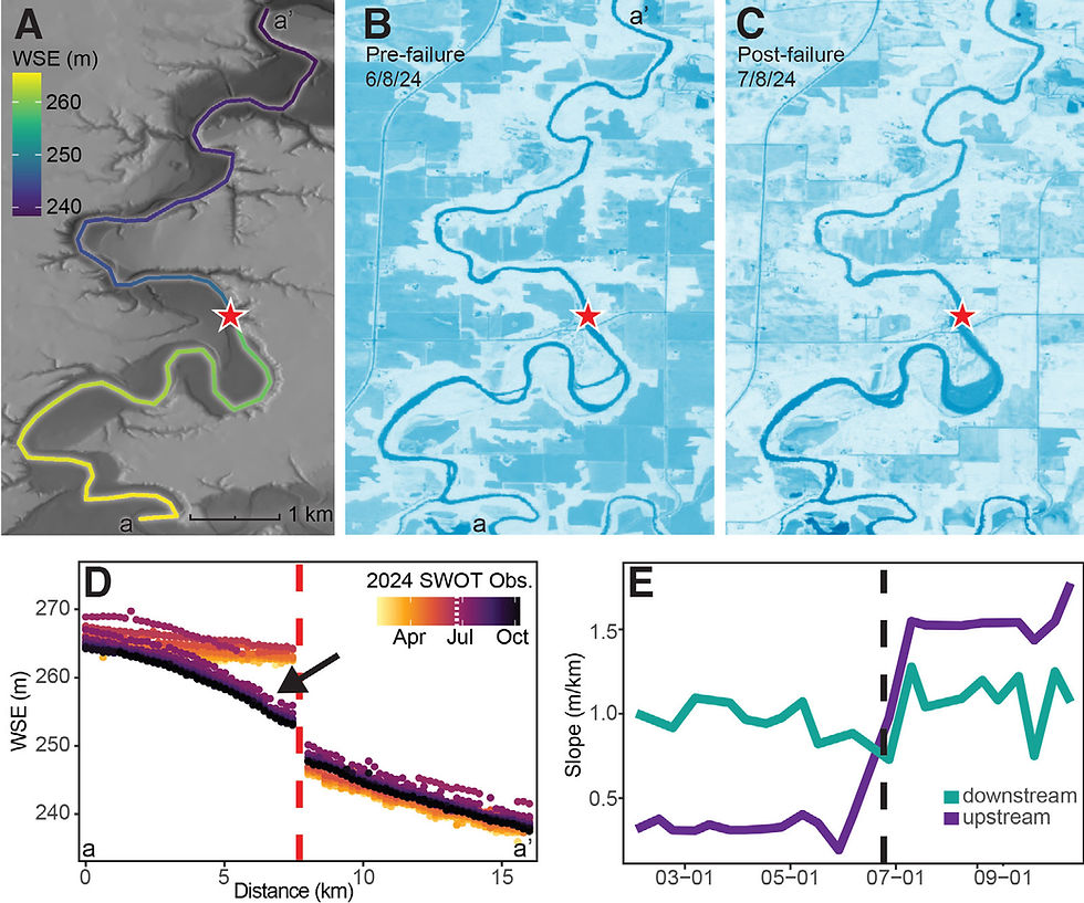
Understanding how these knick zones form and migrate is critical for predicting future erosion and protecting downstream infrastructure. The Rapidan Dam example demonstrates that we now have the capability to track these events globally and at regular intervals. As dams around the world age and the risk of failure increases due to extreme weather, our ability to monitor these unpredictable events from space may be a useful tool for managing floods, dam failures, and their impact on river channels.
Associated publication: Stroud, M., Allen, G.H., et al., 2025, SWOT satellite: A new tool for fluvial geomorphology: GSA Today, v. 35, p. 4–9, https://doi.org/10.1130/GSATG630A.1.


Comments